Showing posts with label Central Carolina Hikes. Show all posts

Saturday, November 1, 2014

Occoneechee Mountain State Recreation Area

The Occoneechee Mountain State Natural Area is recognized as one of the most important natural areas inside the Raleigh, Durham, and Chapel Hill Triangle. The Occoneeche Mountain State Natural Area provides great hiking through various habitats that support species that area rare and significant to this region. This area provides fun hiking and outdoor recreation opportunities for the entire family. Ashley and I really enjoyed being able to hike at the Occoneechee Mountain State Recreation Area on our most recent visit to North Carolina.

Directions to Trailhead: To hike in the Occoneeche Mountain State Natural Area, from I-85 take exit 164, turn north onto Churton Street, turn left at the stop sign onto Orange Grove Road, and turn right onto Virginia Gates Road and follow the signs all the way to the parking area. The address of the Occoneeche Mountain State Natural Area is 625 Virginia Cates Road, Hillsborough, NC 27278.There is no cost for parking at the trailhead area. The park hours are as follows: November - February, 8 a.m. - 6 p.m.; March, April, September & October, 8 a.m. - 8 p.m.; and May - August, 8 a.m. - 9 p.m. the park is closed on Christmas Day.

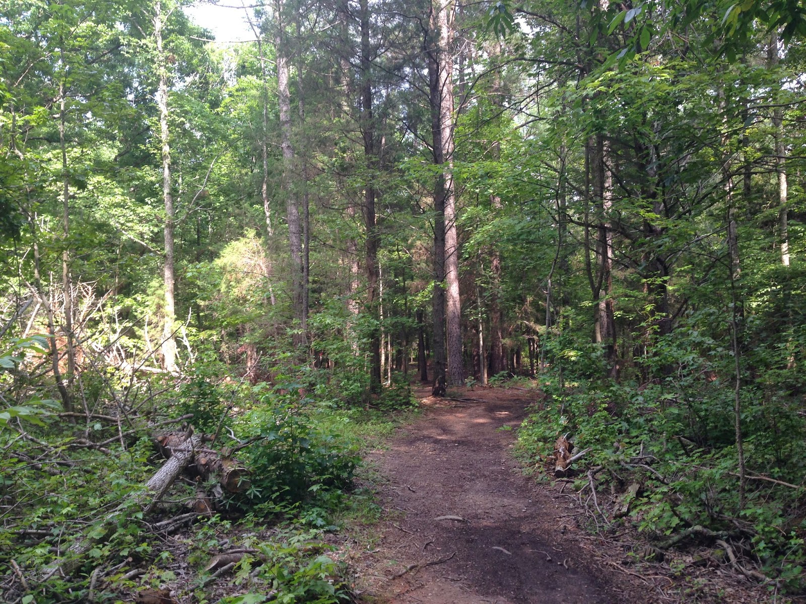
Description of Hike: The Occoneeche Mountain State Natural Area contains 190 acres of land and more than three miles of hiking trails. The area is situated around Occoneeche Mountain Summit (867 feet) which rises 350 feet from the Eno River and is the highest point between Hillsborough, North Carolina and the Atlantic Ocean. The hike Ashley and I completed was the Occoneeche Mountain Loop Trail which is 2.2 miles in length with an elevation gain of just over 300 feet. The Occoneeche Mountain Loop Trail is well marked and is easy to follow. The hike features hilly terrain through mature oak forests and goes along the Eno River. There are several side trails, one we did was the rock quarry view trail below the rock quarry. The Occoneechee Mountain Loop Trail is marked by red circles throughout the park. For a Occoneechee Mountain State Recreation Area park map, click Here.

Further Thoughts: Ashley and I really enjoyed our hike in the Occoneechee Mountain State Recreation Area. We saw several other park visitors while were hiking there and we also got a chance to talk with a very nice park ranger. The summer weather was great with a slight breeze and temperatures in the mid 80s. While on our hike we saw fish, turtles, toads, frogs, a hawk, and several lizards. We found the hiking trails in the Occoneechee Mountain State Recreation Area easy to navigate and follow. The only minor downsides to this hiking area is the power lines running through a portion of the park as well as the close proximity to roads at times.

There are two little fishing ponds that are near the trailhead area where you can go fishing, if that is your cup of tea. The Occoneechee ponds are great for catching bass and bream on worms, crickets, and lures. The Eno is a great place for fly-fishing, casting lures, or baiting with the ever reliable worms and crickets. Most of the river can be waded and there are many openings for bank fishing. Commonly caught game fish include largemouth bass, bluegill, redbreast sunfish, and the feisty Roanoke bass. Roanoke bass, locally know as "red-eye" are found in only four river drainages in northeastern North Carolina and southeastern Virginia. Chubs and bullheads add to the fishing fun. All North Carolina Wildlife Resources Commission fishing regulations are enforced.

The Occoneechee Mountain State Natural Area showcases a diversity of natural communities, and such diversity is found nowhere else in the Triangle area. The relatively undisturbed forest of the ridge top includes one of the best chestnut oak stands in the region. And, the mountain area itself, adjacent to the upper Eno River, is important wildlife habitat. The acorns and berries produced by the chestnut oaks and other area plants support a population of animals, including deer, groundhog and wild turkey.

The top of Occoneechee Mountain's ridge and northern slopes provide habitat for a wide variety of wildlife species that are typically found in the mountains, and some plant species reach their easternmost limits here. These include Bradley's spleenwort and wild sarsaparilla. Catawba rhododendron is present on the steep rock outcrop adjacent to the ravine, and a mountain laurel-galax community grows on the ravine's slopes. Sweet pinesap, another rare plant, also grows here, along with large witch-alder. Yet another mountainous species that grows in the natural area is the purple fringeless orchid.

In addition, several rare animal species found nowhere else in the region are present in the park. These include the brown elfin butterfly. Separated by more than 100 miles from other brown elfin populations in the mountains, the brown elfin butterfly is believed to have survived at Occoneechee Mountain since the Ice Age. Although the brown elfin is found virtually nowhere else in the Piedmont, the population on Occoneechee Mountain is quite large.

Researchers believe that the area's habitat has remained relatively unchanged since the last Ice Age due to the presence of brown elfin, a rare butterfly, as well as several unique plant species. The brown elfin is typically found in mountainous and northern areas, and the nearest brown elfin population to Occoneechee Mountain is more than 100 miles west. When the Piedmont's habitat underwent enormous transformations after the Ice Age, the area became unable to support the brown elfin and other species more accustomed to cooler environments. Brown elfins, believed to have once populated the Piedmont, were restricted to the state's mountains. However, the brown elfin butterflies at Occoneechee Mountain remained.

Rating: Elevation Gain: 300 ft. (Easy), Distance: 2.2 Miles Roundtrip (Easy)

Time to Complete Hike: 1 - 2 hours.


Saturday, September 24, 2011

Duke Gardens (Duke University Durham, North Carolina)

One of the places that Ashley and I had the opportunity to visit and hike at was the Sarah P. Duke Gardens in Durham. This is a beautiful area to explore and relax and the walking trails here are top notch. Duke Gardens is often spoken of as "the crown jewel of Duke University" and is a beautiful place. Duke Gardens occupies 55 acres in the heart of Duke's West Campus and is recognized as one of the premier public gardens in the United States.

Directions to Trailhead: There are several options to reach Duke Gardens. From Chapel Hill and points southwest via 15/501: Take 15/501 North toward Durham, merge right onto the 15/501 bypass, exit onto Hwy. 751 (a.k.a. Cameron Blvd.), turn right at bottom of exit ramp onto Hwy. 751, proceed on Hwy. 751 to third stop light, turn left onto Duke University Road, follow Duke University Road to second stop light, turn left onto Anderson Street, after first intersection, main entrance is 150 yards up on the left (a half-circle drive with stone walls).

From Raleigh and points south and east via I-40 & Hwy. 147 (Durham Freeway): Take I-40 west to Hwy. 147 (Durham Freeway), follow Hwy. 147 to the Swift Avenue exit, turn left onto Swift Avenue, pass one traffic light and proceed to Campus Drive (a four-way stop), turn right onto Campus Drive, proceed to first stop light and turn right onto Anderson Street, main entrance is 150 yards on the left after the intersection (a half-circle drive with stone walls).

From Greensboro and points west via I-85: Take I-85 North to Durham, exit onto Hillandale Road, turn right at the top of exit ramp onto Hillandale Road, continue on Hillandale, which will merge with Fulton Street at the Hwy. 147 overpass, proceed on Fulton Street to the Erwin Road intersection, turn left on Erwin Road, proceed to second stop light,  turn right onto Anderson Street, entrance is about one-half mile up on the right (a half-circle drive with stone walls).

From points north and east via I-85: Take I-85 South to Durham, exit at Hillandale Road, turn left at the top of the exit ramp onto Hillandale Road, continue on Hillandale, which will merge with Fulton Street at the Hwy. 147 overpass, proceed on Fulton Street to the Erwin Road intersection, turn left on Erwin Road, proceed to second stop light, turn right onto Anderson Street, entrance is about one-half mile up on the right (a half-circle drive with stone walls).

Note, there is a fee for parking at Sarah P. Duke Gardens during these hours: Monday through Friday, 8 a.m. to 5 p.m. Saturday and Sunday, 1 p.m. to 5 p.m. They have automated machines to pay at. The current fee is $1 per half an hour for parking. For more information click Here. A map of the area can be found by clicking Here, as well as the Google Map below.

Description of Hike: This is not so much a true hike, but more of an outdoor adventure. When you visit Duke Gardens you will see many people out enjoying the serenity in this area. For an interactive map of the different sections within Duke Garden you can click Here. In reality the elevation gain while exploring Duke Gardens is minimal and you can make your hike/walk as long or as short as you would like. The paths and trails are well maintained. The Google Map below provides the path of where we visited at Duke Gardens. We spent a couple hours here and that was not enough time to visit all sections of Duke Gardens.

Further Thoughts: Ashley and I really enjoyed our visit to Duke Gardens. We enjoyed taking our time and exploring the different sections of Duke Gardens. The trails were well maintained and the best thing was all the plants were labeled so we knew what we were looking at. The amount of care that has to go into the upkeep for Duke Gardens is amazing. It is really tough to capture the beauty and diversity of the plants that are found at Duke Gardens in a blog post. The best way to see the diversity of plant life that is at the gardens is to visit Duke Gardens.

Rating: Elevation Gain: Minimal (Very Easy), Distance: 1 - 2 Miles Roundtrip (Easy).

Time to Complete Hike: 1 - 2 hours.


View Sarah P. Duke Gardens in a larger map

Sunday, September 4, 2011

Durham Museum of Life and Science

One of the places that Ashley and I have visited and explored on multiple occasions is the Durham Museum of Life and Science. The Durham Museum of Life and Science has a little bit of everything and is a great place to visit for the entire family. It is a place the entire family will enjoy. There are a wide variety of both indoor and outdoor adventures at the Durham Museum of Life and Science.

Directions to Trailhead: The Durham Museum of Life and Science is located at 433 West Murray Avenue Durham, NC 27704. Here are some driving directions. From the East, including Raleigh (via I-40) and Fayetteville Take I-40 west from Raleigh to Highway 147 North (Durham Freeway). Take Highway 147 to downtown Durham and take the Duke Street exit (Exit 12C). Drive north two miles on Duke Street. After crossing over I-85, turn right at the third traffic light onto Murray Avenue. As you proceed on Murray Avenue, turn left into the Museum parking lot just past the Mercury Redstone Rocket.

From Raleigh, Highway 70: Take Highway 70 west from Raleigh. Merge onto I-85 south. Go south on I-85 and look for the Museum signs. Take exit 176 (Highway 501 North/Duke Street). Take a right onto Duke Street, go up the hill, and turn right onto Murray Avenue. As you proceed on Murray Avenue, turn left into the Museum parking lot just past the Mercury Redstone Rocket.

From Chapel Hill: Take 15-501 Bypass north. Merge onto I-85 north. Take exit 176B (Highway 501 North/Duke Street). Go up the hill, and turn right onto Murray Avenue. As you proceed on Murray Avenue, turn left into the Museum parking lot just past the Mercury Redstone Rocket.

From the West, including Greensboro: Take I-85 north to Durham and look for the Museum signs. Take exit 176B (Highway 501 North/Duke Street). Go up the hill, and turn right onto Murray Avenue. As you proceed on Murray Avenue, turn left into the Museum parking lot just past the Mercury Redstone Rocket.

Description of Hike: This is not so much a true hike, but is more of an outdoor adventure in Central North Carolina. There is no cost for parking, but there is a cost for admission into the Durham Museum of Life and Science. Admission prices are as follows: $14.00 Adults, $11.00 Seniors (age 65 and older) and active military with ID, $10.00 Children ages 3-12, and members and children under age 3 are admitted free. There are additional charges for some attractions at the Museum of Life and Science as well as more discounts and group rates available. For more admission charges and ride costs click Here. The neat thing is you can make your walk/hike around this area of the Durham Museum of Life and Science as long or as short as you would like to.

The Durham Museum of Life and Science is one of North Carolina’s top attractions and is situated on 84 acres of land. The interactive science park includes a science center, a butterfly conservatory which is one of the largest in the world, a beautifully landscaped outdoor exhibits which are safe havens for rescued black bears, lemurs, and endangered red wolves. You want to make sure you get a chance to see the red wolf exhibit as well as the other animals that call the Durham Museum of Life and Science home.

The Museum's Dinosaur Trail, which is great for kids, takes visitors on a journey through the late Cretaceous period. Other attractions include a Farmyard, Ellerbe Creek Railway, Contraptions – a hands-on exhibit for older children and adults, a sailboat pond, The Lab, Play to Learn – an exhibit for children under six, more than 60 species of live animals and so much more. For information on daily programs at the Durham Museum of Life and Science click Here. Bottom-line is there are so many exhibits and things that everyone in the family will find something that interests them.

Further Thoughts: Ashley and I really enjoyed our visit to the Durham Museum of Life and Science. We had the opportunity to look at the butterfly conservatory which was amazing. It was cool to see so many butterfly's in one room. We also enjoyed the explore the wild trail. This trail goes through the museum's wildlife exhibits. They have black bear, lemurs, the endangered red wolf, and much more. The trail meanders through some beautiful parts of the outdoor property the Museum of Life and Science sits on.

Inside the museum there are even more things to do. They have an exhibit with indoor animals that has snakes, otters, alligators, owls, and other wildlife. Additionally, they have exhibits on space travel, flight, and so much more. There is much to do at the Museum of Life and Science and you would likely need a couple of days to do it all at a pace you would enjoy. If you are interested in information on how to become a member of the Durham Museum of Life and Science click Here. This is fun that the whole family can enjoy together.

For more pictures of animals at the Durham Museum of Life and Science click Here.

Rating: Elevation Gain: Minimal (Very Easy), Distance: 1 - 3 Miles Roundtrip (Easy).

Time to Complete Hike: Variable depending on how many things you look at, from a couple of hours to all day.


View Durham Museum of Life and Science in a larger map

Wednesday, August 31, 2011

Eno River State Park North Carolina (Buckquarter Creek & Holden Mill Trail Loop)

One of the hikes that Ashley and I had the opportunity to do was the Buckquarter Creek & Holden Mill Trail Loop in the Eno River State Park. The Eno River State Park is well maintained and is a great place to go hiking in Central North Carolina. The Buckquarter Creek & Holden Mill Trail Loop closely follows the Eno River and gives you a great chance at seeing local wildlife. For more pictures make sure to check out our Facebook Page.

Directions to Trailhead: The Eno River State Park is located in Durham and Orange counties, northwest of the city of Durham. There are two options to get to the trailhead for the Cox Mountain Trail, which is located in the Fews Ford Access of the Eno River State Park. The first option is if you are driving from Interstate 85 exit 173, take Cole Mill Road northwest away from Durham. After five miles, Cole Mill Road will end at the park's Fews Ford Access and there are signs directing you to this trail. The second option is if you are driving from Interstate 85 exit 170, take Hwy. 70 west to Pleasant Green Road. Turn right and follow Pleasant Green 2.2 miles, then turn left on Cole Mill Road. After one mile, Cole Mill Road will enter the park's Fews Ford Access and there are signs directing you to this trail. For a map click Here, or look at the Google Map below.

Description of Hike: The Buckquarter Creek & Holden Mill Trail Loop is a combination of two different trails into a longer hike. The Buckquarter Creek Trail is a 1.5 mile loop that begins at the Piper Cox Museum parking lot and turns upriver at Few's Ford. The Buckquarter Creek Trail is marked with red dots in addition to the brown signs with white letters. There is roughly a 50 foot rise in elevation with this trail. The most spectacular rapids on the Eno River are viewed from a rock outcrop along this trail. A staircase takes hikers over the outcrop. The trail follows the Eno River and then turns upland going over rolling hills. It is at this point that you connect with the Holden Mill Trail. 

The Holden Mill Trail is a 2.6 mile loop trail that continues west from the Buckquarter Creek Trail from a bridge that spans the creek. The Holden Mill Trail is marked with yellow dots in addition to the brown signs with white letters. The best option is to head left and continue along the Eno River. A couple of portions of the Holdern Mill Trail were a little overgrown when we did this hike. On the way back from the end of the Holden Mill Loop there is roughly 250 of elevation gain and loss before you get back to the beginning of the loop. The total roundtrip mileage for this hike is 4.1 miles with 300 feet of elevation gain.

There is no cost for parking and hiking at the Eno River State Park, but there are fee's if you camp in the wilderness campgrounds located in the park. Trail maps are provided at the beginning of the trails near the parking lot. The Eno River State Park contains more than 3,900 acres of wilderness. There are a total of five accesses to the Eno River State Park: Cabe Lands, Cole Mill, Few’s Ford, Pleasant Green, and Pump Station. To find out the times at which the different sections of the Eno River State Park are open click Here. As stated above the Buckquarter Creek & Holden Mill Trail Loop is located in the Few's Ford access point.

Further Thoughts: Ashley and I really enjoyed our hike on this loop in the Eno River State Park. The majority of the trail was in great shape. A couple of sections on the Holden Mill trail were a little overgrown when we hiked this area. We got a chance to see a lot of wildlife while hiking here at the Eno River State Park. We saw several white tail deer, a number of toads, fish, and a beaver dam. For more information on the ecology of the Eno River click Here.

The Eno River State Park is only minutes from Durham, Hillsborough, and Chapel Hill and it offers secluded wilderness trails with the serenity of a clear river drifting and cascading over a rocky stream bed. The Eno River is a swift, shallow stream flowing from northwest Orange County into Durham County for 33 miles where it joins the Flat River to become the Neuse and flows into Falls Lake. Its waters roll through wilderness, passing historic mill sites, river bluffs covered with flowering shrubs, and fords used by early settlers. Rains can turn the river into a raging torrent, yet it quickly settles into a gentle current. It is a chain of rapids, pools, and riffles meandering through forest on a bed of rock. The valley of the river is narrow and steep walled. The rugged landscape has been carved and sculpted by the swift flowing water.

This loop in particular provides great views of the Eno River. You might even see people fishing in the river when you are on this hike. There is plenty of shade along the entire trail, however there is not as much shade once the trees lose their leaves in the fall. If you are hiking during the warm summer months make sure to bring plenty of water and to use bug spray. The only minor negative about this hike was the high tension power lines that run through a portion of the park. Ashley and I both would recommend a hike in the Eno River State Park and both enjoyed our hike on this particular trail. 

Rating: Elevation Gain: 300 ft. (Easy), Distance: 4.1 Miles Roundtrip (Easy - Moderate).

Time to Complete Hike: 1.5 - 2.5 hours.

MORE TRAIL WRITE-UPS ON THE ENO RIVER STATE PARK

Buckquarter Creek & Holden Mill Trail Loop (This Post)

Eno River State Park (Cox Mountain Trail)

One of the hikes that Ashley and I had the opportunity to hike was the Cox Mountain Trail in the Eno River State Park. The Eno River State Park is well maintained and is a great place to go hiking. The Cox Mountain Trail was a fun hike that we both enjoyed. For more pictures make sure to check out our Facebook Page.

Directions to Trailhead: The Eno River State Park is located in Durham and Orange counties, northwest of the city of Durham. There are two options to get to the trailhead for the Cox Mountain Trail, which is located in the Fews Ford Access of the Eno River State Park. The first option is if you are driving from Interstate 85 exit 173, take Cole Mill Road northwest away from Durham. After five miles, Cole Mill Road will end at the park's Fews Ford Access. The second option is if you are driving from Interstate 85 exit 170, take Hwy. 70 west to Pleasant Green Road. Turn right and follow Pleasant Green 2.2 miles, then turn left on Cole Mill Road. After one mile, Cole Mill Road will enter the park's Fews Ford Access. For a map click Here, or look at the Google Map below.

Description of Hike: The Cox Mountain Trail is located in the Western portion of the Eno River State Park. The Cox Mountain Trail is a loop and is 3.75 miles roundtrip. The hike can be lengthened by adding the Fanny's Ford Trail loop, which adds another mile to the distance. The elevation gain on the Cox Mountain Trail is 270 feet. Trail maps are provided at the entrance to the trails. One of the best things about this park is that the trails are well marked. The Cox Mountain Trail is blazed with blue dots along the trail in addition to brown signs with white letters at all trail intersections.

Additionally, if you are looking for longer hikes, this area of the Eno River State Park offers a total of 14.19 miles of hiking trails along the Eno River. The trails vary from easy to more strenuous, but you can combine a number of trails to make hikes as short or as long as you would like them. There is no cost for parking and hiking at the Eno River State Park, but there are fee's if you camp in the wilderness campgrounds located in the park. The Eno River State Park contains more than 3,900 acres of wilderness. There are a total of five accesses to the Eno River State Park: Cabe Lands, Cole Mill, Few’s Ford, Pleasant Green, and Pump Station. To find out the times at which the different sections of the Eno River State Park are open click Here. As stated above the Cox Mountain Trail is located in the Few's Ford access point.

Further Thoughts: Ashley and I really enjoyed hiking at the Cox Mountain Trail in the Eno River State Park. The trail was in great shape and one of the coolest parts of this hike is the suspension bridge that you get to cross. The suspension bridge is a great location to get good pictures of the Eno River below you. This is a fun hike and you have a great chance at seeing local wildlife while here. We saw several deer, toads, fish, and several different types of birds. For more information on the ecology of the Eno River click Here.

The Eno River State Park is only minutes from Durham, Hillsborough, and Chapel Hill and it offers secluded wilderness trails with the serenity of a clear river drifting and cascading over a rocky stream bed. The Eno River is a swift, shallow stream flowing from northwest Orange County into Durham County for 33 miles where it joins the Flat River to become the Neuse and flows into Falls Lake. Its waters roll through wilderness, passing historic mill sites, river bluffs covered with flowering shrubs, and fords used by early settlers. Rains can turn the river into a raging torrent, yet it quickly settles into a gentle current. It is a chain of rapids, pools, and riffles meandering through forest on a bed of rock. The valley of the river is narrow and steep walled. The rugged landscape has been carved and sculpted by the swift flowing water.

Lastly, while we were hiking in the Eno River State Park there was a small summer thunderstorm that developed a couple of miles away. It was real neat to be hiking in this forested area while listening to the crashes of thunder several miles away. The only negative to this hike is the high tension power lines that run through a portion of the park. Despite that one minor negative, the Eno River State Park is a great hiking location. Ashley and I both highly recommend the Cox Mountain Trail.

Rating: Elevation Gain: 270 ft. (Easy), Distance: 3.75 Miles Roundtrip (Easy).

Time to Complete Hike: 1.5 - 2.5 hours.

MORE TRAIL WRITE-UPS ON THE ENO RIVER STATE PARK

Cox Mountain Trail (This Post)