Showing posts with label Hiking. Show all posts

Saturday, November 1, 2014

Occoneechee Mountain State Recreation Area

The Occoneechee Mountain State Natural Area is recognized as one of the most important natural areas inside the Raleigh, Durham, and Chapel Hill Triangle. The Occoneeche Mountain State Natural Area provides great hiking through various habitats that support species that area rare and significant to this region. This area provides fun hiking and outdoor recreation opportunities for the entire family. Ashley and I really enjoyed being able to hike at the Occoneechee Mountain State Recreation Area on our most recent visit to North Carolina.

Directions to Trailhead: To hike in the Occoneeche Mountain State Natural Area, from I-85 take exit 164, turn north onto Churton Street, turn left at the stop sign onto Orange Grove Road, and turn right onto Virginia Gates Road and follow the signs all the way to the parking area. The address of the Occoneeche Mountain State Natural Area is 625 Virginia Cates Road, Hillsborough, NC 27278.There is no cost for parking at the trailhead area. The park hours are as follows: November - February, 8 a.m. - 6 p.m.; March, April, September & October, 8 a.m. - 8 p.m.; and May - August, 8 a.m. - 9 p.m. the park is closed on Christmas Day.

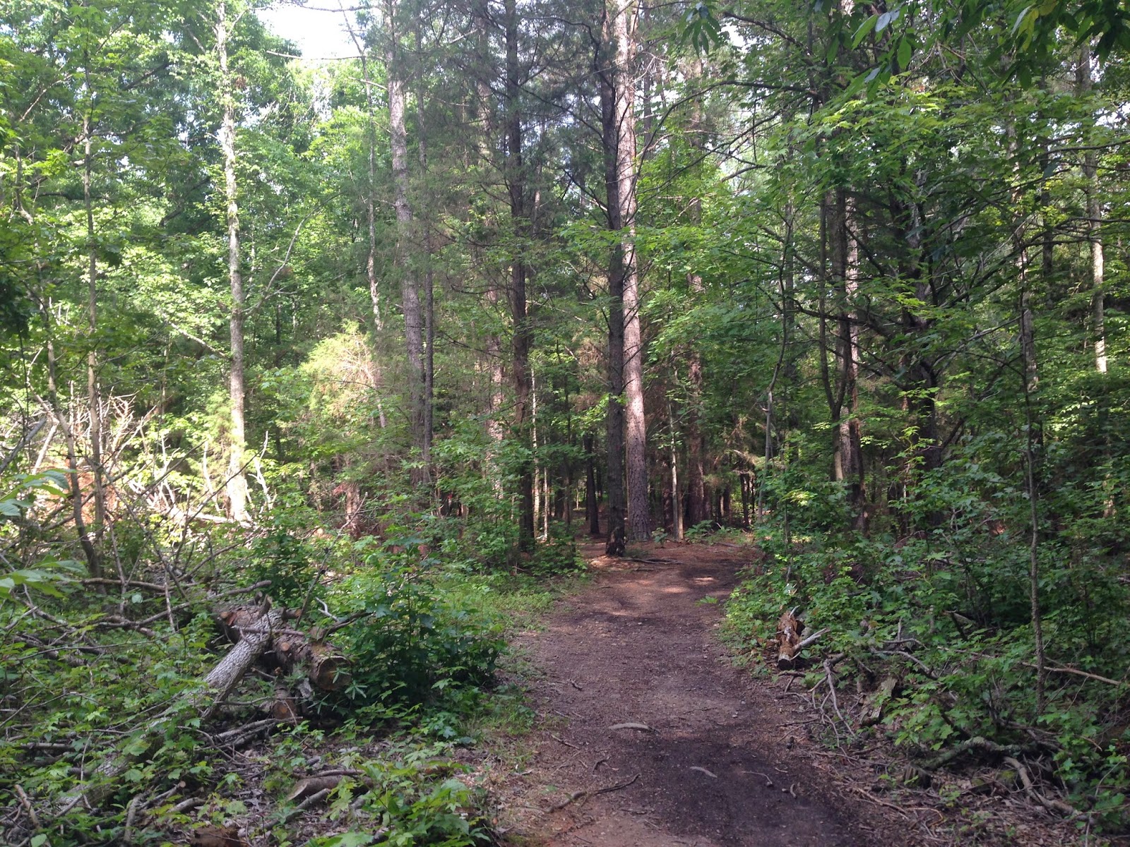
Description of Hike: The Occoneeche Mountain State Natural Area contains 190 acres of land and more than three miles of hiking trails. The area is situated around Occoneeche Mountain Summit (867 feet) which rises 350 feet from the Eno River and is the highest point between Hillsborough, North Carolina and the Atlantic Ocean. The hike Ashley and I completed was the Occoneeche Mountain Loop Trail which is 2.2 miles in length with an elevation gain of just over 300 feet. The Occoneeche Mountain Loop Trail is well marked and is easy to follow. The hike features hilly terrain through mature oak forests and goes along the Eno River. There are several side trails, one we did was the rock quarry view trail below the rock quarry. The Occoneechee Mountain Loop Trail is marked by red circles throughout the park. For a Occoneechee Mountain State Recreation Area park map, click Here.

Further Thoughts: Ashley and I really enjoyed our hike in the Occoneechee Mountain State Recreation Area. We saw several other park visitors while were hiking there and we also got a chance to talk with a very nice park ranger. The summer weather was great with a slight breeze and temperatures in the mid 80s. While on our hike we saw fish, turtles, toads, frogs, a hawk, and several lizards. We found the hiking trails in the Occoneechee Mountain State Recreation Area easy to navigate and follow. The only minor downsides to this hiking area is the power lines running through a portion of the park as well as the close proximity to roads at times.

There are two little fishing ponds that are near the trailhead area where you can go fishing, if that is your cup of tea. The Occoneechee ponds are great for catching bass and bream on worms, crickets, and lures. The Eno is a great place for fly-fishing, casting lures, or baiting with the ever reliable worms and crickets. Most of the river can be waded and there are many openings for bank fishing. Commonly caught game fish include largemouth bass, bluegill, redbreast sunfish, and the feisty Roanoke bass. Roanoke bass, locally know as "red-eye" are found in only four river drainages in northeastern North Carolina and southeastern Virginia. Chubs and bullheads add to the fishing fun. All North Carolina Wildlife Resources Commission fishing regulations are enforced.

The Occoneechee Mountain State Natural Area showcases a diversity of natural communities, and such diversity is found nowhere else in the Triangle area. The relatively undisturbed forest of the ridge top includes one of the best chestnut oak stands in the region. And, the mountain area itself, adjacent to the upper Eno River, is important wildlife habitat. The acorns and berries produced by the chestnut oaks and other area plants support a population of animals, including deer, groundhog and wild turkey.

The top of Occoneechee Mountain's ridge and northern slopes provide habitat for a wide variety of wildlife species that are typically found in the mountains, and some plant species reach their easternmost limits here. These include Bradley's spleenwort and wild sarsaparilla. Catawba rhododendron is present on the steep rock outcrop adjacent to the ravine, and a mountain laurel-galax community grows on the ravine's slopes. Sweet pinesap, another rare plant, also grows here, along with large witch-alder. Yet another mountainous species that grows in the natural area is the purple fringeless orchid.

In addition, several rare animal species found nowhere else in the region are present in the park. These include the brown elfin butterfly. Separated by more than 100 miles from other brown elfin populations in the mountains, the brown elfin butterfly is believed to have survived at Occoneechee Mountain since the Ice Age. Although the brown elfin is found virtually nowhere else in the Piedmont, the population on Occoneechee Mountain is quite large.

Researchers believe that the area's habitat has remained relatively unchanged since the last Ice Age due to the presence of brown elfin, a rare butterfly, as well as several unique plant species. The brown elfin is typically found in mountainous and northern areas, and the nearest brown elfin population to Occoneechee Mountain is more than 100 miles west. When the Piedmont's habitat underwent enormous transformations after the Ice Age, the area became unable to support the brown elfin and other species more accustomed to cooler environments. Brown elfins, believed to have once populated the Piedmont, were restricted to the state's mountains. However, the brown elfin butterflies at Occoneechee Mountain remained.

Rating: Elevation Gain: 300 ft. (Easy), Distance: 2.2 Miles Roundtrip (Easy)

Time to Complete Hike: 1 - 2 hours.


Thursday, August 16, 2012

The Blowing Rock (Blowing Rock North Carolina)

One of the places we had the chance to visit on a recent trip was The Blowing Rock which is just outside of the town of Blowing Rock North Carolina. This is a fun little adventure that allows you to stop and see some of the beauty of the North Carolina Mountains as well as learn about the local folklore surrounding the legend of the Blowing Rock.

Directions to Trailhead: The Blowing Rock is located just outside of the Town of Blowing Rock North Carolina. From the Town of Blowing Rock North Carolina take the 321 South (Blowing Rock Boulevard) toward The Blowing Rock. The turn off will be on your righthand side in roughly 1.5 - 2 miles. Click Here for a map to The Blowing Rock.

Description of Hike: This is an out and back hike on a well maintained short trail system. The trail system at The Blowing Rock is mostly paved with minimal elevation gain. The entire trail system is approximately 1,200 feet long and thus is very family friendly. Business hours vary by season and weather conditions, click Here for a list of business hours and prices for admission to the Blowing Rock. To download a copy of the trail map for The Blowing Rock click Here.

Further Thoughts: This was a fun short hike that offered great views of the Pisgah National Forest in North Carolina. Although the trails are short and some would call this a tourist trap, in our opinion The Blowing Rock is worth a visit due to the spectacular views and scenery it provides visitors. The price for admission when we visited was $6 per adult which was reasonable. We enjoyed learning about the legend surrounding The Blowing Rock and took in the tremendous views the trails offered.

It is said that a Chickasaw chieftan, fearful of a white man’s admiration for his lovely daughter, journeyed far from the plains to bring her to The Blowing Rock and the care of a squaw mother. One day the maiden, daydreaming on the craggy cliff, spied a Cherokee brave wandering in the wilderness far below and playfully shot an arrow in his direction. The flirtation worked because soon he appeared before her wigwam, courted her with songs of his land and they became lovers, wandering the pathless woodlands and along the crystal streams.

One day a strange reddening of the sky brought the brave and the maiden to The Blowing Rock. To him it was a sign of trouble commanding his return to his tribe in the plains. With the maiden’s entreaties not to leave her, the brave, torn by conflict of duty and heart, leaped from The Rock into the wilderness far below. The grief-stricken maiden prayed daily to the Great Spirit until one evening with a reddening sky, a gust of wind blew her lover back onto The Rock and into her arms. From that day a perpetual wind has blown up onto The Rock from the valley below. For people of other days, at least, this was explanation enough for The Blowing Rock’s mysterious winds causing even the snow to fall upside down.

Overall our visit and hike at The Blowing Rock was fun and we would recommend it to others. There is a very tranquil feel to the air in the North Carolina Mountains and we look forward to visiting again soon.

Rating: Elevation Gain: Minimal (Very Easy), Distance: 0.25 Miles (Very Easy).

Time to Complete Hike: 20 minutes.


View The Blowing Rock in a larger map

Tuesday, August 14, 2012

Patsy Pond Nature Trail (Croatan National Forest)

Ashley and I recently had the chance to do some hiking in Coastal North Carolina. One of the trails that we did was the Patsy Pond Nature Trail in the Croatan National Forest. This is a fun short trail that offers a great chance to see North Carolina wildlife in Coastal North Carolina. For more pictures make sure to check out our Facebook Page.

Directions to Trailhead: The trailhead to hike the Patsy Pond Nature Trail is located on Highway 24 midway between Cape Carteret and Morehead City, in the community of Ocean.  The trailhead parking area is 1/2 mile west of Croatan High School and across the highway from the NC Coastal Federation office. There is no cost for parking at the trailhead.

Description of Hike: The Patsy Pond Nature Trail area is a well maintained and well marked set of dirt hiking trails that are relatively flat. There are three loops set up for hikers to chose from. There is the green trail loop which is 0.75 miles roundtrip, there is the blue trail loop which is 1 mile roundtrip, and there is the yellow trail which is 1.9 miles roundtrip.  Ashley and I did the yellow loop which provides a great view of the larger patsy pond and is the loop that we would recommend to others. The trails in the park are marked well, with signs indicating the trail. The markers are color coordinated according to the trail that you hike. There are interpretative markers around the green and blue trails that provide information on the wide variety of plants and wildlife that are found in the Croatan National Forest. For a printable map of the trails click Here.

Further Thoughts: Ashley and I really enjoyed this hike in Coastal Carolina. Even though we went during the summer months we had plenty of cloud cover as we went in the morning. We saw toads, frogs, lizards, and plenty of deer tracks, however the best wildlife encounter we had was with a turtle that was crossing the trail. We took some pictures with the large turtle and helped him across the trail. When we went there was only one other car at the trailhead and when you go on  this hike, you have the chance to have the trails to yourself.

The Patsy Pond Nature Trail is part of Croatan National Forest. It winds through an area referred to as Longleaf Pine Flat Woods, which is an open woodland of longleaf pines with low growing herbs and shrubs. There are natural ponds and sinkholes, native flora and fauna along the trails. Encompassing 160,000 acres of coastal forest and wetlands, the Croatan National Forest is North Carolina's only large coastal forest and one of the few places where the pocosin (a subcategory of wetland) can still be found. A network of access areas features camping, 43.1 miles of hiking trails, fishing, picnicking, nature walks, boating, and more. The Patsy Pond Nature Trail(s) are open during daylight hours only. Additionally, if you go hiking here during hunting season which is October to February and April to May, you are encouraged to wear highly visible orange vests or hats.

A wide variety of wildlife inhabits this area. When hiking here you have the opportunity to see songbirds, wading birds, osprey, wild turkey, woodpeckers, white tail deer, gray fox, grey squirrel, flying squirrel, black bear, lizards, turtles, and snakes. Bottom-line is to make sure to have your camera ready as you never know when you will encounter wildlife.

Rating: Green Trail: Elevation Gain: < 50 ft. (Very Easy), Distance: 0.75 Miles Roundtrip (Very Easy). Blue Trail: Elevation Gain < 50 ft. (Very Easy), Distance: 1 Mile Roundtrip (Easy). Yellow Trail: Elevation Gain: < 50 ft. (Very Easy), Distance: 1.9 Miles Roundtrip (Easy).

Time to Complete Hike: 0.5 - 2 hours.

MORE WRITE-UPS ON THE CROATAN NATIONAL FOREST

Patsy Pond Nature Trail (This Post)


View Patsy Pond Nature Trail in a larger map

Wednesday, May 2, 2012

Blue Ridge Parkway

One of the places that we have had the opportunity to visit/drive on while in North Carolina was the Blue Ridge Parkway. Obviously, we did not drive the whole Blue Ridge Parkway as it runs for 469 miles, but the section we drove (50 miles) clearly demonstrated why this drive is noted for its scenic beauty and is a must do for everyone. If you have not had the chance to drive on the Blue Ridge Parkway, you should schedule a road trip very soon!

History and Description of the Blue Ridge Parkway:  Construction of the Blue Ridge Parkway begun during the administration of U.S. president Franklin D. Roosevelt, the project was originally called the Appalachian Scenic Highway. Most construction was carried out by private contractors under federal contracts under an authorization by Harold L. Ickes in his role as federal public works administrator. Work began on September 11, 1935, near Cumberland Knob in North Carolina; construction in Virginia began the following February. On June 30, 1936, Congress formally authorized the project as the Blue Ridge Parkway and placed it under the jurisdiction of the National Park Service. Some work was carried out by various New Deal public works agencies. The Works Progress Administration did some roadway construction. Crews from the Emergency Relief Administration carried out landscape work and development of parkway recreation areas. Personnel from four Civilian Conservation Corps camps worked on roadside cleanup, roadside plantings, grading slopes, and improving adjacent fields and forest lands. During World War II, the CCC crews were replaced by conscientious objectors in the Civilian Public Service program.

Construction of the parkway took over 52 years to complete, with the last stretch (near the Linn Cove Viaduct) being laid around Grandfather Mountain in 1987. The Blue Ridge Parkway tunnels were constructed through the rock—one in Virginia and twenty-five in North Carolina. Sections of the parkway near the tunnels are often closed in winter. (Due to dripping groundwater from above, freezing temperatures, and the lack of sunlight, ice often accumulates inside these areas even when the surrounding areas are above freezing.) The highest point on the parkway (south of Waynesville, near Mount Pisgah in North Carolina) is 6053 feet on Richland Balsam Mountain at Milepost 431, and is often closed from November to April due to inclement weather such as snow, fog, and even freezing fog from low clouds. The parkway is carried across streams, railway ravines and cross roads by 168 bridges and six viaducts.

The parkway runs from the southern terminus of Shenandoah National Park's Skyline Drive in Virginia at Rockfish Gap to U.S. Route 441 at Oconaluftee in the Great Smoky Mountains National Park near Cherokee, North Carolina. There is no fee for using the parkway, however commercial vehicles are prohibited without approval from the Park Service Headquarters, near Asheville, North Carolina. The roadway is not maintained in the winter, and sections which pass over especially high elevations and through tunnels are often impassable and therefore closed from late fall through early spring. Weather is extremely variable in the mountains, so conditions and closures often change rapidly. The speed limit is never higher than 45 mph (70 km/h) and lower in some sections.

Further Thoughts: The Blue Ridge Parkway is truly an inspirational drive. We visited both Grandfather Mountain and The Blowing Rock which are close to the blue ridge parkway. We are no experts concerning the ins and outs of the road, however it does not take one to say that at some point in your life you need to experience a ride along the Blue Ride Parkway which is one of the most scenic drives in North Carolina we have ever done. You want to be on the lookout for wildlife while driving on the Blue Ridge Parkway as we did see a number of deer close to the side of the Blue Ridge Parkway in a number of sections.

Also make sure to take your time while driving on the parkway as there are many stopping points along the way that offer scenic vistas as well places to stop, hike, shop, and look around. If you are looking for more information about places to visit along the Blue Ridge Parkway click Here for another good site or Here for the National Park Service Website.

Rating: Elevation Gain: Varies depending on how much you get out of your car (Easy), Distance: Varies depending on how much you get out of your car (Easy).

Time to Complete Hike: It really depends on how long you stop, your speed, and a number of other factors. The main thing when driving on the Blue Ridge Parkway is to take your time and enjoy the stops along the way.

Overview

Northern Virginia

Southern Virginia

Northern NC

Middle NC

Southern NC

Sunday, October 30, 2011

Alligator River National Wildlife Refuge (Red Wolf Howling Safari)


One of the places that Ashley and I had the opportunity to visit this past summer in North Carolina was the Alligator River National Wildlife Refuge. The Alligator River National Wildlife Refuge is a very unique place with the highest population of black bears on the east coast of the United States and is one of the only areas in the world that you can see the endangered red wolf in the wild. We did the Wildlife Drive, a hike on the Creef Cut Wildlife Trail, the Bear Tour, and the Red Wolf Howling Safari while visiting the Alligator River National Wildlife Refuge. (In the video above, the red wolf howling starts at around the 4 second mark and you can hear the wolves best around the 30 second mark and 45 second mark, you might have to turn your speakers up. Also sorry for background noise as people were walking)

Directions to Trailhead: The trailhead for the Creef Cut Wildlife Trail at the Alligator River National Wildlife Refuge is located in Eastern North Carolina. The address for the trailhead is Milltail Road East Lake, NC 27953. For more information or directions to the Alligator River National Wildlife Refuge their office phone is: 252-473-1131 and their fax number: 252-473-1668. For directions and information for road networks in North Carolina click Here.

Description of Hike: Registration is now not required to take part in the Red Wolf Howling Safari however for inquiries about the Safaris you can call 252-216-9464. Usually the Red Wolf Howling Safari's are only offered during the summer months in North Carolina. Summer Howling Safari's cost $7 per person and Children 12 and under are free. However, they also offered Red Wolf Howling Safari's on other dates throughout the year that are free. For a list of the Red Wolf Howling Safari dates click Here. The Red Wolf Howling Safari is not a true hike, but is more of an outdoor experience. The Red Wolf Howling Safari begins at the Creef Cut Wildlife Trail parking area. For a map of that location click Here. The Red Wolf Howling Safari begins with a informational gathering where you learn about the Red Wolf. This is a perfect adventure for kids to do. After the informational portion of the Red Wolf Howling Safari, you travel in a large caravan of cars deep into the Alligator River National Wildlife Refuge to a secluded location deep in the woods. Here, you howl and hopefully the wolves howl back at you!

Further Thoughts: Ashley and I really enjoyed the Red Wolf Howling Safari. The informational portion of the Safari was great. You get to learn about the almost extinction of the Red Wolf and how the captive breeding program has led to the re-introduction of the Red Wolf into the wild again. Their program is modeled similarly to the program used to introduce the grey wolf back into the greater Yellowstone Ecosystem. You can also hold the pelts of Red Wolfs that have died of natural causes at the Alligator River National Wildlife Refuge.

The Red Wolf Howling Safari is something that the entire family will enjoy. There were many families on the safari when we went as we can tell it is a popular program. The Red Wolf Howling Safari typically lasts about two hours. You are going to want to make sure you bring a flashlight and insect repellent. Also, dress for the weather; the Red Wolf Howling Safari will occur except with lightning, heavy rain, or wind or impassable roads. Decision to cancel will be made at least 1.5 hours prior to the scheduled program. Also, plan ahead! The Creef Cut Wildlife Trail is about a 20 minute drive from Manteo. (Picture on this paragraph from Durham Museum of Life and Science)

Make sure you exercise patience when you get to the howling portion of the safari. The wolves usually cooperate and howl back at you (But it is not always guaranteed). It took the wolves about 15 minutes to begin to howl back at us. Unfortunately by that some people had given up and began to walk back to the place their cars were parked. Overall, Ashley and I would highly recommend the Red Wolf Howling Safari. We really enjoyed it in addition to spending a day at the Alligator River National Wildlife Refuge. (Picture on this paragraph from Durham Museum of Life and Science)

Rating: Elevation Gain: Minimal (Very Easy), Distance: 0.25 Miles (Very Easy).

Time to Complete Hike: 2 hours.

MORE TRAIL WRITE-UPS ON THE ALLIGATOR NATIONAL WILDLIFE REFUGE


Red Wolf Howling Safari (This Post)


View Red Wolf Howling Safari in a larger map

Monday, October 17, 2011

Alligator River National Wildlife Refuge (Creef Cut Wildlife Trail)


One of the places that Ashley and I had the opportunity to visit and hike in was the Alligator River National Wildlife Refuge. The Alligator River National Wildlife Refuge is a very unique place with the highest population of black bears on the east coast of the United States and is one of the only areas in the world that you can see the endangered red wolf in the wild. We did the Wildlife Drive, a hike on the Creef Cut Wildlife Trail, the Bear Tour, and the Red Wolf Howling Safari while visiting the Alligator River National Wildlife Refuge.


Directions to Trailhead: The trailhead for the Creef Cut Wildlife Trail at the Alligator River National Wildlife Refuge is located in Eastern North Carolina. The address for the trailhead  is Milltail Road East Lake, NC 27953. For more information or directions to the Alligator River National Wildlife Refuge their office phone is: 252-473-1131 and their fax number: 252-473-1668. For directions and information for road networks in North Carolina click Here.

Description of Hike: The Creef Cut Wildlife Trail is a half-mile long (1 mile roundtrip) hike with minimal elevation gain. It is an out an back hike. There is an informal trail that continues all the way to the highway which would make the total hike close to 2.5 miles roundtrip. It is a universally-accessible trail that's ideal for school groups or families, as well as individuals. A kiosk at the trailhead provides information about the refuge and the habitats and wildlife that occur. Also at the trailhead is a universally-accessible fishing platform. Since there is a canal that links this site directly with South Lake, there is a constant supply of crappie, bluegill, and other freshwater fish. A state fishing license is required.Interpretive signs along the trail identify vegetation types or wildlife that may be seen in the area. A 200-foot boardwalk takes visitors out onto the freshwater marsh to the north of the trail. On the south, an overlook provides viewing of the Creef Moist Soil management area where waterfowl, raptors, and other migratory birds can be seen. The entire Alligator River National Wildlife Refuge is open during daylight hours only, a 1/2 hour before sunrise to a 1/2 hour after sunset. The speed limit on all refuge roads, unless otherwise posted, is 35 miles per hour. Motorized vehicles are allowed only on designated roads. For a map of the trails location Here.

Further Thoughts: Ashley and I really enjoyed our hike on the Creef Cut Wildlife Trail in the Alligator River National Wildlife Refuge. The majority of the trail is paved, which is good because of the marshy terrain this Coastal North Carolina Hike goes through. You have an excellent chance of seeing wildlife while on this hike. When Ashley and I were on the trail there were fresh black bear tracks that crossed the trail in several places. Additionally, we were told that alligators frequent some of the ponds there.

The Alligator River National Wildlife Refuge encompasses a broad expanse (152,000 acres) of wildlands and waters. There are many options available to explore the refuge and the designated wildlife drive and trails offer the best wildlife viewing opportunities. Black bear, deer, river otters, and red wolves, along with a variety of birds, reptiles, and amphibians may be seen here. During the winter months, large numbers of waterfowl and other migratory birds are present.

We would suggest that you make sure to bring plenty of insect repellent and water, especially during the hot summer months. Additionally, to better see wildlife at the viewing areas, you might want to bring a pair of binoculars. The Alligator River National Wildlife Refuge offers a wide variety of programs that you can attend. They have the Red Wolf Howling Safari, Bear Tours, and much more. For a list of programs click Here.

Rating: Elevation Gain: Minimal (Very Easy), Distance: 1 Mile Roundtrip (Easy).

Time to Complete Hike: 30 minutes to 1 hour.

MORE TRAIL WRITE-UPS ON THE ALLIGATOR NATIONAL WILDLIFE REFUGE

Creef Cut Wildlife Trail (This Post)

Red Wolf Howling Safari

Sunday, October 16, 2011

Alligator River National Wildlife Refuge (Wildlife Drive)

One of the places that Ashley and I had the opportunity to visit and explore was the Alligator River National Wildlife Refuge. The Alligator River National Wildlife Refuge is a very unique place with the highest population of black bears on the east coast of the United States and is one of the only areas in the world that you can see the endangered red wolf in the wild. We did the Wildlife Drive, a hike on the Creef Cut Wildlife Trail, the Bear Tour, and the Red Wolf Howling Safari while visiting the Alligator River National Wildlife Refuge.

Directions to Trailhead: The Alligator River National Wildlife Refuge is located in Eastern North Carolina. The address for the Alligator River National Wildlife Refuge is Milltail Road East Lake, NC 27953. Office Phone: 252-473-1131, Fax: 252-473-1668. For directions and information for road networks in North Carolina click Here.

Description of Hike: The wildlife drive, is not a hike, but is a drive through the vast expanse of the Alligator National Wildlife Refuge. The drive allows you to see how expansive the Alligator National Wildlife Refuge is and provides you with an excellent opportunity to view wildlife. While on the drive Ashley and I did see 2 black bears. There is no cost to drive on the refuge, but donations are welcome. The refuge is open during daylight hours only, a 1/2 hour before sunrise to a 1/2 hour after sunset. The speed limit on all refuge roads, unless otherwise posted, is 35 miles per hour. Motorized vehicles are allowed only on designated roads. When driving on the refuge, when you stop, make sure that your vehicle does not block the road, or you risk the possibility of citations. One other priority is to make sure you have a full gas tank when you go on the drive as there are no gas stations in the immediate vicinity. For a map of the drive click Here.

Further Thoughts: Ashley and I really enjoyed our visit to the Alligator River National Wildlife Refuge. We especially enjoyed the wildlife drive because it truly allowed us the opportunity to see the wide variety of habitat and large expanses of land that compose the Alligator River National Wildlife Refuge.

The Alligator River National Wildlife Refuge encompasses a broad expanse (152,000 acres) of wildlands and waters. There are many options available to explore the refuge and the designated wildlife drive and trails offer the best wildlife viewing opportunities. Black bear, deer, river otters, and red wolves, along with a variety of birds, reptiles, and amphibians may be seen here. During the winter months, large numbers of waterfowl and other migratory birds are present.

Ashley and I had the chance to see many different types of birds and we even saw two black bears while on our drive in the refuge as well as several deer. Wildlife in the refuge is usually most active at dusk and dawn. Ashley and I highly recommend that you bring plenty of insect repellent and water, especially during the hot summer months. Additionally, to see the wildlife best, make sure to bring a pair of binoculars or even better a spotting scope! Furthermore, the Alligator River National Wildlife Refuge offers a wide variety of programs that you can attend. They have the Red Wolf Howling Safari, Bear Tours, and much more. For a list of programs click Here.

Rating: Elevation Gain: Varies depending on how much you get out of your car (Easy), Distance: Varies depending on how much you get out of your car (Easy).

Time to Complete Hike: 1 - 2 hours. (It really depends on how long you stop to watch for wildlife in each area.

MORE TRAIL WRITE-UPS ON THE ALLIGATOR NATIONAL WILDLIFE REFUGE


Wildlife Drive (This Post)

View Alligator River National Wildlife Refuge in a larger map